FAQ
HOA
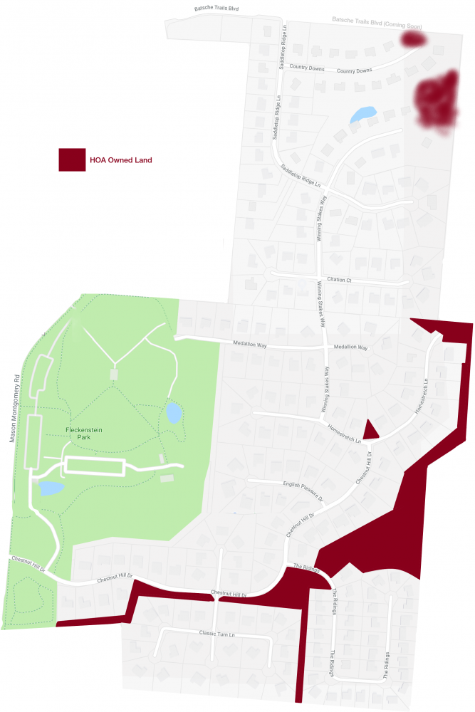
The Chestnut Hill HOA owns several pieces of land in our development. Refer to the map below.
Remember, the “HOA” is not a mysterious third party that owns the land – it is all of us who own a home in Chestnut Hill. It is up to all of us to maintain and protect our investment.

Improvement Applications
Click HERE and refer to figure 1183 to see how the City of Mason defines front, side, and rear yards. Know that, because Chestnut Hill is in Mason and Deerfield, the HOA Board has instructed the Design and Review Committee to apply this diagram for the consistency of all new Improvement Applications for a few years now.
Outside Chestnut Hill
The land immediately north of Chestnut Hill is Batsche Trails Blvd (or land set aside for the continuation of the Blvd.). To learn about other landowners in the area, visit the Warren County Auditor’s website HERE.
According to the City of Mason’s Thoroughfare Plan (HERE), yes. This is outside the Chestnut Hill development and the HOA is not involved in the paving of streets nor the zoning of cities.
Yes. Click HERE to visit ProjectMason.com. You will see that eventually there will be a bike path that will connect our neighborhood to the Loveland-Miami bike path!
